Shallow deep monitoring
We provide geo-electromagnetic prospecting techniques aimed at defining and characterizing the structure of the subsoil from the first meters to the hundreds of meters of depth.
The range of environmental survey services are:
- Geological-structural: to seek underground water and to map large cavities at risk collapse (sinkholes);
- Archaeological: identification of underground buried archaeological structures (such as tombs, flooring and artifacts in general) and their mapping on supports digital map;
- Environmental: geophysical survey techniques offer a wide scenario applications in this field: the mapping and zoning of underground landfills, the localization of hazardous waste buried.
 Utilities Detection and Mapping: A utility map shows the positioning and identification of buried pipes and cables beneath the ground. Combine mapping process with a topographical survey and the results will provide you with a comprehensive detailed map of utilities.
Benefits
Infrastructures safety; sinkholes risk mitigation; subsoil characterization and monitoring
Customers
Telecommunication, transportation, energy supply companies, cultural heritage institutions, civil protection authorities.
 Technology
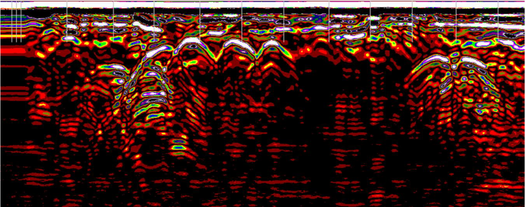
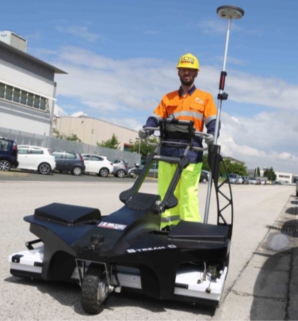
- GPR (Ground Penetrating Radar) with wide spectrum of multifrequency antennas;
- Electrical tomography, resistivity and induced polarization surveys;
- Magnetometer Geometrics optically pumped magnetometers and gradiometric for archeology;
- Electromagnetic induction methods in the frequency domain (FDEM) fixed frequency and multifrequency; Methods in time domain electromagnetic induction (TDEM);
- GPS (Global Positionning System) RTK geodetic receivers.